Settings
The settings menu allows users to configure various settings for the GPS server mobile application.
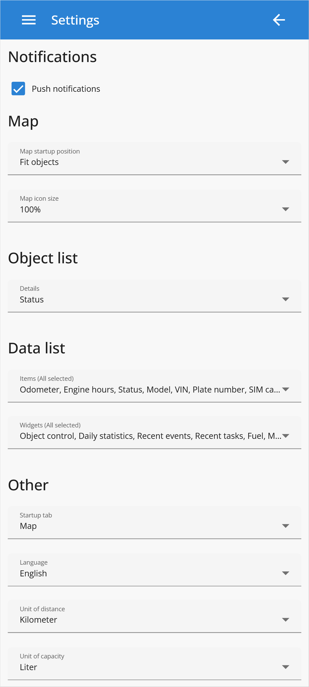
Push notifications - Enables push notification reception.
Map - GPS-server mobile application Map settings.
Map startup position - Specifies how the map will be displayed.
Default - Displays the entire map of the world.
Remember last - Opens the map at the last position viewed.
Fit objects - Adjusts the map to fit all objects displayed.
Map icon size - Allows to change object icon, marker and event icon size.
Object list - Specifies the information to be displayed next to objects in the object list.
Time (position) - Date and Time when the message from tracking device was sent.
Time (server) - Date and Time when the message was received on the server.
Status - Provides the current status of the object.
Data list - Enables to turn on/off what information and which widgets will be displayed in the Data list.
Other - Additional GPS-server mobile application settings.
Startup tab - Allows the user to set the default tab to open when the application starts.
Language - Select the language of the application.
Units of distance - Set the distance units: kilometer, mile or nautical mile.
Units of capacity - Set the units for the capacity: liter or gallon.
Unit of temperature - Set the temperature units: Celsius or Fahrenheit.
Time zone - Set timezone for the account in UTC format.
Daylight saving time (DST) - Set the time at which the clock is automatically advanced by one hour during the summer months.
Change password - Allows to change account password.