Maps
The Maps section allows the administrator to select and customize the maps that are displayed in the front-end of the application. This feature allows to choose from a variety of existing maps and also add your own custom TMS and WMS maps.
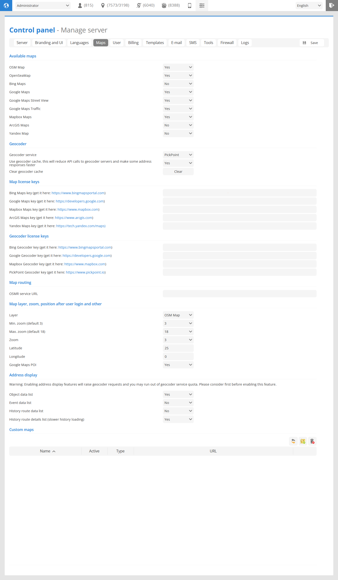
Available maps
Allows to select maps that will be available for the user to select.
Geocoder
Geocoder service - select geocoding service that will be used to provide address information.
Use geocoder cache - stores the geocoder address information in GPS-server cache, this will reduce API calls to geocoder servers and make some address responses faster.
Clear geocoder cache - removes stored in cache address information.
Map license keys
In this section Maps API keys need to be entered form Bing maps, Google maps, Mapbox or Yandex maps.
Geocoder license keys
In this section Geocoding API keys need to be entered form Bing, Google, Mapbox or Pickpoint maps.
Map routing
OSMR service URL - allows to use own OpenStreetMap server with GPS-server software.
Map layer, zoom, position after user login and other
Layer - set the map that will loaded for the user during first login.
Min. zoom (default 3) - set the minimal zoom level available for the users.
Max. zoom (default 18) - set the maximal zoom level available for the users.
Zoom - set the map zoom that will be displayed after login.
Latitude and Latitude - position of the map that will be displayed after user login.
Google Maps POI - enable or disable viewing Google Maps points of interest.
Address display
Set in which sections of the GPS-server software addresses will be displayed.
Please note
Enabling address display features will raise geocoder requests and you may run out of geocoder service quota. Please consider first before enabling this feature.
Custom maps
In this section custom maps TMS and WMS can be set.
 - reload custom maps list.
 - opens new custom map creation menu.
 - removes all custom maps.
Custom map properties
To add new custom map click on the button.
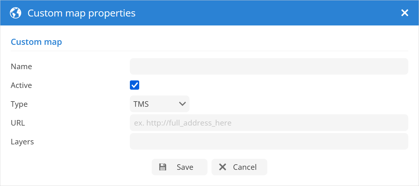
Name - name of the new custom map.
Active - enable or disable custom map.
Type - select the type of the custom map TMS or WMS.
URL - url of the the custom map.
Layers - set layers of the custom map.