History
The History section provides a comprehensive overview of all relevant information pertaining to objects, including route details, stop locations, addresses, time schedules, zones.

Object - Select the object whose history you wish to display.
Filter - Convenient method to set the time period for the report.
Stops - Establish the time frame for stops to be included in the report, allowing for the exclusion of stops at traffic lights.
Show - Returns historical information for the selected object for a specified period of time in 4 tabs: Map, Route, Graph, Messages.
Map
In this tab, user can view the route traveled by the selected object on the map for the specified timeframe. This feature allows you to track the path taken by the object over a defined period, providing valuable insights into its movements and activities.

Graphic elements - each history event is marked with icon:
 - Indicates the starting point of the route.
 - Marks the endpoint of the route.
 - Identifies locations where the object stopped along the route.
 - Indicates locations where events were generated during the route.
 - playback bar contains following control elements:
Play/Pause - Starts/Pauses playback of the objects route.
Stop - Stops playback of object history travel.
Progress bar - Indicates current playback progress.
Playback Speed - Allows to select playback speed.
Route
This tab offers both general and detailed information about the traveled route for the selected period.

In the General route information section, you can find details such as Route length, Average speed, Fuel consumption, and more.
The Details section displays a list of historical events along with additional information such as event time, location, and duration.
Graphic elements - each history record is marked with icon:
- Indicates that object was moving at that moment.
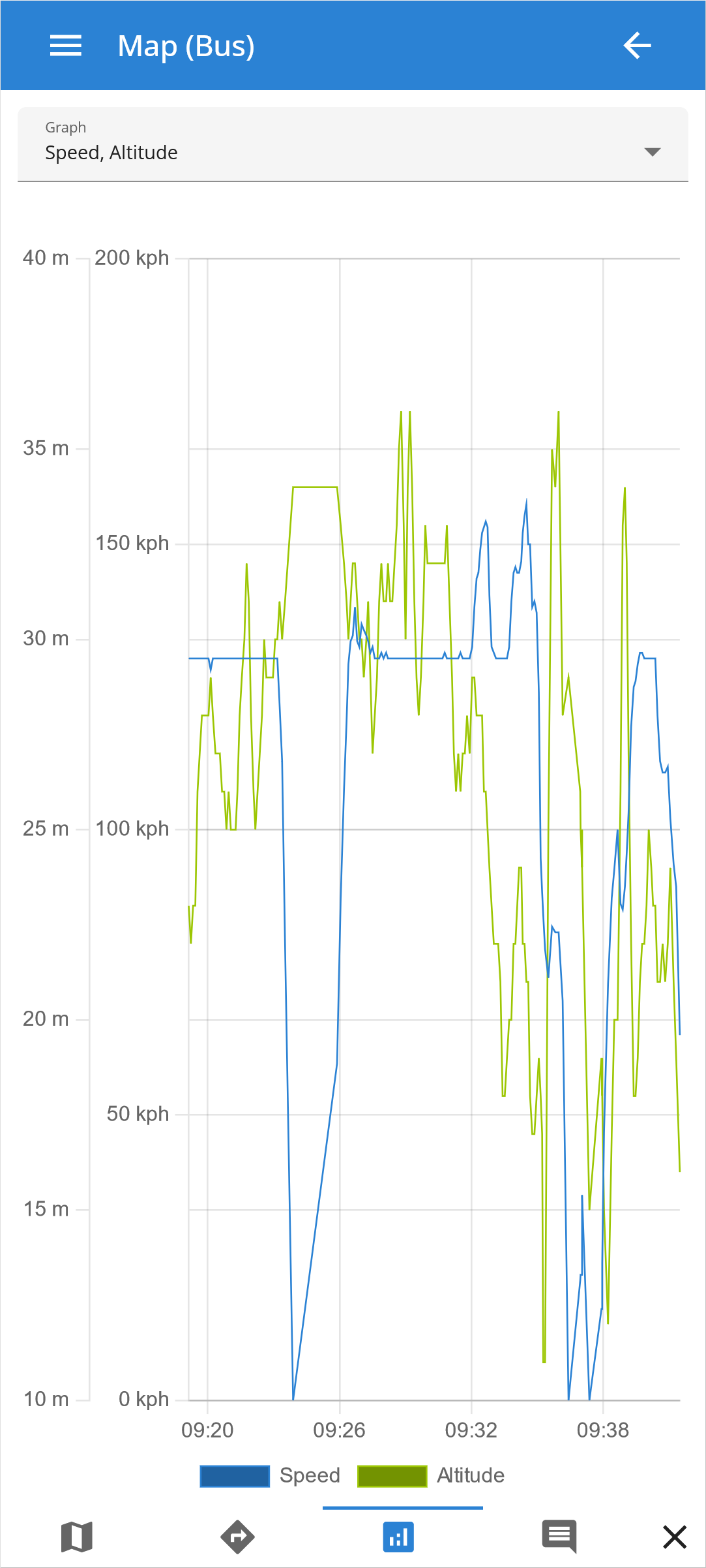
Graph
The history graph displays the results of various configured sensors for the selected GPS tracking device such as speed, altitude, ignition, fuel level, temperature and others, over a specified period of time. This allows users to visualize and analyze the sensor readings and track changes in these readings over time.
Please note!
The drop-down menu provides the option to select up to three sensor diagrams to be displayed simultaneously, allowing for an efficient and convenient comparison of multiple sensor readings.
Messages
The location messages feature provides a comprehensive list of all location points received from the selected GPS tracking device over a specified time period. The ability to view this data provides a clear understanding of device behavior and enhances the accuracy of sensor readings.
