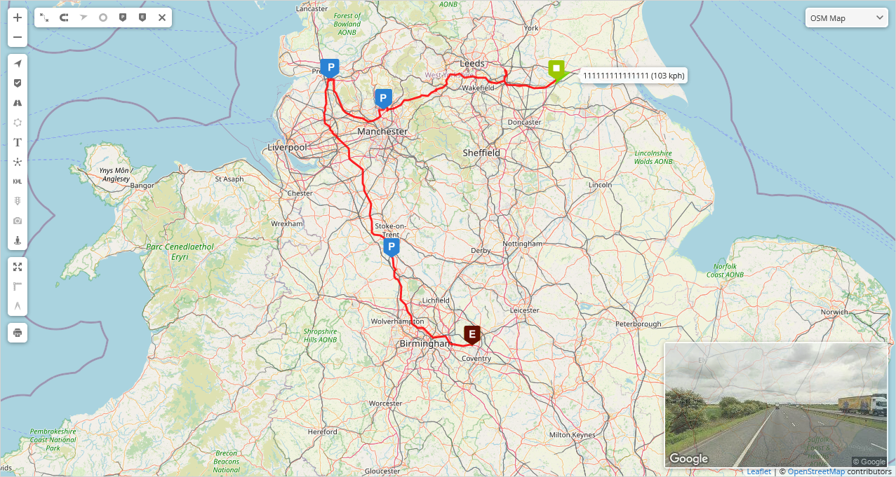
Map
The map section provides users with the ability to observe objects in real-time or trace the path taken by an object when the history data is loaded.
Map controls
The map controls bar is a set of user interface elements that allow users to make adjustments to the displayed information on the map. These features provide users with more control over the displayed information, enabling them to tailor the map view to their specific needs.
 - increase map Zoom level.
 - decrease map Zoom level.
 - enable/disable visibility of all objects on the map.
 - enable/disable visibility of all markers on the map.
 - enable/disable visibility of all routes on the map.
 - enable/disable visibility of all zones on the map.
 - enable/disable visibility of all labels on the map.
 - clusters combine nearby markers and objects into marker and object groups that display content within the group depending on the zoom level of the map.reveal content inside of it.
 - enable/disable display of the latest image captured by the tracking device on the map workspace screen.
 - enable/disable the display of Google Maps Street View on the main workspace screen.
 - enable/disable the visibility of all KML geodata on the map.
 - shows the status of traffic on the map (only available with Google Maps).
 - sets the zoom level of the map to fit all objects.
 - measures the area marked on the map.
 - prints the selected map area in portrait or landscape format.
Route controls
The Route control bar appears on the map when the object history is loaded and allows to to make adjustments to the displayed information on the map.
 - enable/disable visibility of traveled routes on the map.
 - align the traveled path in accordance with the real road.
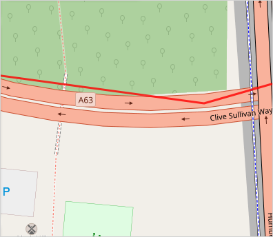
Snap off
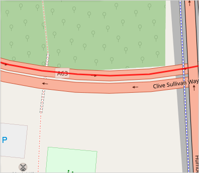
Snap on
 - toggle the display of direction arrows that indicate the travel direction of an object.
 - toggle the visibility of points where the device transmitted information to the server.
 - enable/disable the display of markers that show on the map where the object has stopped.
 - turn on or off the markers on the map that indicate where the event was created.
 - close Route controls bar.
Maps
Allows users switching the currently used map: OSM, Google, Bing, Mapbox, Yandex or any other custom TMS or WMS map.
Context menu
After right-clicking on any point on the map, a context menu will appear.

Street View (new window) - Opens a new window with Google Street View of the selected location.
Show point - Displays the address and coordinates of the selected location.
Route to point - Generates a route from the object to the selected point on the map.
Route between points - Generates a route between two selected points on the map.
New task - Allows selecting two points for a new task, opening the new Task window afterward.
New marker - Sets a point for a new marker, then opens the new Marker window.
New route - Sets a first point for a new route and opens the new Route window.
New zone - Sets a first point for a new zone and opens the new Zone window.