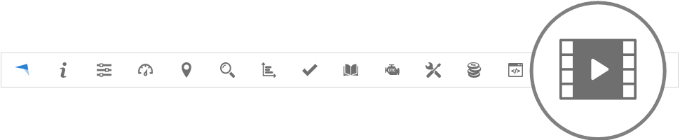
Logo
  • Create account
  • Workspace
  • Top panel
    • About
    • Help
    • Settings
      • Objects
        • Objects
          • Object properties
          • Main
          • Icon
          • Fuel consumption
          • Accuracy
          • Sensors
            • Sensor properties
            • Sensor parameters
            • Sensor configuration
          • Service
            • Service properties
          • Custom fields
            • Custom field properties
          • Info
        • Groups
          • Object group properties
        • Drivers
          • Object driver properties
        • Passengers
          • Object passenger properties
        • Trailers
          • Object trailer properties
      • Events
        • Main
        • Time
        • Notifications
        • Webhook
        • Object control
      • Templates
        • Template properties
      • KML
        • KML properties
      • SMS
        • Mobile application
        • HTTP
      • User interface
      • My account
      • Sub accounts
        • Sub account properties
    • Dashboard
    • Show point
    • Address search
    • Reports
      • Report properties
      • Generated
    • Tasks
      • Task properties
    • RFID and iButton logbook
    • DTC (Diagnostic Trouble Codes)
    • Maintenance
      • Maintenance service properties
    • Expenses
      • Expense properties
    • Object control
      • GPRS
      • SMS
      • Schedule
        • Schedule properties
      • Templates
        • Command properties
    • Image gallery
    • Video gallery
    • Chat
  • Side panel
    • Objects
      • Share position
      • Share position properties
    • Events
    • Places
      • Markers
        • Marker Properties
      • Routes
        • Route properties
      • Zones
        • Zone properties
    • History
      • Graph
      • Location messages
  • Map
    • Map controls
    • Route controls
    • Maps
    • Context menu
  • Bottom panel
    • Data
    • Graph
    • Messages
  • User account panel
    • Billing
    • Purchase plan
    • Activate objects
  • Control panel
    • User list
      • Add user
      • User properties
        • Contact information
        • Sub accounts
        • Objects
        • Billing plans
        • Usage
    • Object list
      • Add object
    • Unused object list
    • Billing plan list
    • Mobile applications
    • Manage server
      • Server
      • Branding and UI
        • Theme properties
      • Languages
        • Edit language
      • Maps
        • Custom map properties
      • User
      • Billing
        • Billing properties
      • Templates
        • Template properties
      • E-mail
      • SMS
        • Mobile application
        • HTTP
      • Tools
      • Firewall
        • Firewall IP properties
      • Logs
  • Mobile applications
    • GPS Server Mobile
      • Dashboard
      • Map
      • Objects
        • Objects data
      • Events
      • Places
        • Markers
        • Routes
        • Zones
      • History
        • Map
        • Route
        • Graph
        • Messages
      • Reports
        • Generated
        • New
      • Object control
        • GPRS
        • SMS
      • Image gallery
      • Video gallery
      • Settings
    • GPS Tracker
    • SMS Gateway
  • HOW TO
    • General Information
      • Travel route incorrectly displayed and looks like a mess of lines, how to solve this?
      • Why I see straight lines in the route?
      • Sudden jumps appear in route, why it happens?
      • How to configure Teltonika device?
      • Getting incorrect fuel level readings
      • I am using Google API but can't see address in account
      • How to check what Hosted server plan I'm using and when the activation ends?
      • How to create Zone inside of the Zone
    • E-mail
      • Brevo setup
  • FAQ
    • General questions
      • If I press SOS button, will any sound signal appear on PC?
      • Can I add more than one e-mail to event?
      • How big is location packet that GPS device is sending to server?
      • Can I connect camera to my GPS device and view it on server?
      • Why I don’t see Administrator panel when I use your server?
      • Can I show on my website map from your server so my customers can see how cars are moving?
      • I have GPS tracker, which is not listed in your supported devices list, what should I do?
      • When I add new device for trial I receive "Inactive Object" error message.
      • How to connect temperature, fuel or any other sensor?
      • If I purchase Hosted server plan and want to upgrade how much will it cost?
      • Can't send e-mail. Contact administrator, what should I do?
      • How to configure billing?
      • Why email messages can't be delivered?
      • How to get API documentation?
      • How Hexadecimal to bin formula works?
      • Beacon moved away notification
      • How to configure RFID?
      • How to configure iButton?
      • How RAG report score is calculated?
    • Maps
      • How to get Google Maps key?
      • What maps can be used in GPS-server?
      • How to use Google Geocoder in GPS-server software?
    • Mobile applications
      • Can I use your tracking software on my mobile phone?
      • Why SMS gateway doesn't work?
      • How to enable push notifications?
GPS-server
  • Top panel
  • Video gallery
Previous Next

Video gallery

To access the Videos gallery, press video button in Top panel.

../_images/top_bar_big_video_gallery.png

In Video gallery user can view videos received from tracking devices.
Videos can be up to 30 seconds long and are stored for 30 days on the server.

../_images/video_gallery1.png

  • Objects - Select the device from which the received videos will be displayed.

  • Filter - quickly select the time period for which videos are to be displayed.

  • Time from/Time to - precise way to specify the period for which videos are to be displayed.

  • download - download video.

  • remove - delete video.

  • refresh - refreshes videos list.

  • action - Open action menu.

    • remove - deletes all selected video records.

Please note!

Video functionality is currently supported only for Teltonika DualCam and Teltonika DashCam devices.

The camera device must be connected to a compatible tracking device.

The Teltonika tracking device must be pointed to server PORT: 11922, while the Teltonika camera device must be pointed to server PORT: 11924.

The entire configuration of the camera device must be carried out in the Teltonika Configurator software.


Previous Next

© Copyright 2024 GPS-server.net. All Rights Reserved.